top of page

WW II


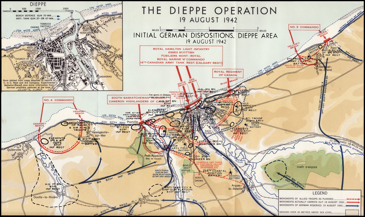
This map shows the detailed routes that were taken by both the Allied Forces and the Regiments contained within them and the Nazis. This map also displays the designated gunner spots on the Dieppe beach for both sides. Every confrontation in every city is displayed .
Link: http://www.ibiblio.org/hyperwar/UN/Canada/CA/SixYears/maps/SixYears-5.jpg
OPERATION MAP
bottom of page